


Sports, recreation and physical activity cluster
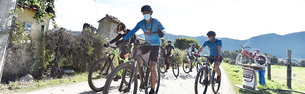
Pedaling through Cundinamarca

How can we help you?


We want to improve your experience
Your experience inspires us to improve. Please rate our website using the following survey.
If you wish to make a request, petition or suggestion, you can do so through our SPQyF system and contact us:

Route of the blade
Salitre – Guasca – Alto de la Cuchilla

Level of complexity: ◉◉◉◉◉

The Cuchilla pass is the highest point of the road that leads from the Bogotá savannah to the Guavio valley. Its ascent runs between green pastures and simple peasant houses, passes through huge pine forests and ends with the characteristic vegetation of the Andean paramo landscape. All this in a winding route that between one curve and another shows us the landscape of the valley and the long reservoir of Tominé.
48.4 kilometers and a disturbing maximum altitude of 3,365 m/snm serve as the backdrop for this route. It begins with 24.2 kilometers one way, starting from the traffic circle that marks the entrance to Sopó, continues along the road to the municipality of Guasca and reaches the Alto del Salitre, in an ascent of 2.5 kilometers and an average gradient of 6%, which, however, is nothing more than a warm-up for the biggest prize: the mythical La Cuchilla pass, 12 kilometers long and one of the highest in the world.
It is a highly demanding route, not so much because of its gradient, which generally remains at an average of 7%, but because of the weather conditions that reduce the air flow and increase the feeling of suffocation of any cyclist. That is why it is recommended that those who do it for the first time have some experience in long ascents.
On the route it is common to see long lines of amateur riders as if it were a massive pilgrimage that has in common the desire to crown the ascent to the mountain. Guasca, in fact, has become a favorite cycling destination for amateurs. The little traffic, the tranquility, the landscape and the good conditions of the road are some of the attractions that most attract cyclists and make this route not only a true standard of the best ports for cycling in Colombia, but also the scene of competitions such as the Gran Fondo de New York, which in its LATAM Championship 2019 edition, traced its route through these roads.
All this without mentioning the ecotourism and historical sites such as the Natural Reserve El Chochal de Siecha, 8.1 kilometers from the urban area, ideal for bird watching. Or the Petroglifos del Pajarito, 2 kilometers from the municipality -more than 2,000 years old-, a jewel of rock art inherited from the indigenous settlements that populated the region before the Muiscas.
Upon arrival of the cyclists on the outskirts of Guasca, after the 26-kilometer prologue, they can ride around the town along the variant of Avenida Ruta Nacional 50. Or, as a second option, they can climb up to Guasca and cross its streets, although this means having to overcome a couple of ramps before entering the town center.
After a short descent, at the exit of Guasca begins the La Cuchilla pass. It is approximately 12 kilometers of very regular ascent, between 5 and 7% of inclination, with few and short rests and a thick fog, mist, mistress and mistress of these lands. At this point, it is best to be cautious and dose the force, maintaining a continuous cadence to control the energy expenditure, a key aspect for an ascent that reaches 3,365 m/snm.
With 3 kilometers to go, the vegetation indicates the arrival of the moor. Dwarf trees, mosses and frailejones grow on both sides of the road while the cold gets colder and colder. Oxygen is scarce and each pedal represents an enormous effort. After the last horseshoe we only have to overcome the long straight from where we can see the small sign announcing the finish line.
The summit is a rather inhospitable place where the clouds cover almost everything. There is no place to rest or shelter from the cold. If you are lucky you can find a makeshift stand under an umbrella where you can buy water or something sweet to regain strength.
On the way back, it is best to stop at one of Guasca's restaurants before continuing on to El Salirte, where you can find a wide variety of gastronomic offerings ranging from picadas or traditional food in the center of town at places like Piqueteadero La Casona or Restaurante El Corralito Guasca, to offerings like Restaurante el Café de la Huerta, with vegetarian menus, grill and fish.
Flying goal:
Before leaving Guasca, try to visit the Siecha Chapel, declared a national monument in 1991 for its architectural value. An old Dominican doctrine church dating from the eighteenth century and is located in the Vereda San Isidro. The entrance fee is $2,000 for those curious about colonial architecture.
Very close to the Chapel are the Siecha Lagoons: Fausto, America and Siecha. Located in the Chingaza National Natural Park, they cover an area of 50,374 hectares. Siecha, which in the ancient Muisca language meant "man of water", was the sacred temple and place of worship of the indigenous peoples, who used to give gold and precious stones to their gods through the depth of its waters. Later, in colonial times, they were drained to extract gold pieces.
If you have reached the cuchilla and still feel like it, descend to Gachatá where hot springs, trout and corn arepas are waiting for you to recover your energy.
Was this content useful to you?


Share it on:


