


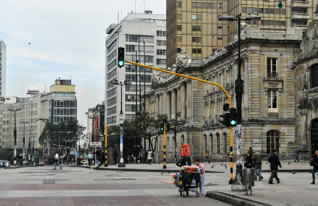
Bogota Land Management Plan
 Help and support center
 Accesibility
 Rate your expirience
How can we help you?


We want to improve your experience
Knowing your experience inspires us to improve. Rate our website through the following survey.
If you wish to make a request, petition or suggestion, you can do so through our SPQyF system and contact us:

Bogota Land Management Plan
The Land Management Plan (POT) is a technical and regulatory instrument for managing the municipal or district territory. Law 388 of 1997 defines it as the set of objectives, guidelines, policies, strategies, goals, programs, actions and regulations adopted to guide and manage the physical development of the territory and land use.
It is the basic instrument for developing the municipal land-use planning process. The POT is a navigation chart to organize urban and rural land in order to consolidate a city model in the long term and for this purpose it designs a series of instruments and mechanisms that contribute to its development.
What is it for?

The POT is used to guide and prioritize investments in the territory by both the public and private sectors, i.e., it defines where parks, schools, hospitals, housing, offices, stores and industries are to be built.


How are these instruments classified?
Land Management Plan: These are prepared and adopted by the authorities of districts and municipalities with a population of over 100,000 inhabitants.
Basic Land Management Plan: These are prepared and adopted by the authorities of municipalities with a population between 30,000 and 100,000 inhabitants.
Land Management Scheme: These are prepared and adopted by the authorities of municipalities with a population of less than 30,000 inhabitants.
What does it contain?

General component
Define strategic content and structural content
Strategic content:
Comprises policies, objectives, territorial strategies and medium (8 years) and long-term (12 years) content. It defines: occupation, use and management of land and natural resources, measures for environmental protection, conservation of natural resources and defense of the landscape. Also, the identification of actions to take advantage of its comparative advantages and its greater competitiveness based on the vocation, opportunities and territorial capacities. As well as, the definition of the necessary actions to guarantee the economic, environmental and social development of the municipality.
Structural content:
Defines the land occupation model, sets strategies for the location and spatial distribution of activities, determines the major infrastructure required to support these activities and establishes the characteristics of road communication systems, as well as determines: environmental and heritage protection and conservation areas, high-risk zones for the location of human settlements, the classification of land into urban, rural and urban expansion, existing and projected basic infrastructure, as well as reserve areas for road, transportation and public services infrastructure, public space, equipment, infrastructure for special tourism projects, among others.

Urban component
Establishes the norms and decisions for the administration of the development, occupation and management of land classified as urban and urban expansion.
This component contains the medium and short term policies, in harmony with the land occupation model, as well as the determinations on: conservation areas and environmental and heritage protection, zones with threat and risk conditions, urban actions, actions, urban treatments, activity areas, planning, management and financing instruments, and the objectives, strategies and instruments for the execution of social housing programs.

Rural component
Rural Component: Establishes the norms and decisions to guarantee adequate interaction between rural settlements and the municipal capital, as well as the use of rural land, and public actions aimed at providing the infrastructure and basic equipment necessary to serve the rural population.
This component contains medium and short-term policies for the use and occupation of rural land, as well as determinations on: activities and land use, conditions for protection, conservation and improvement of agricultural, forestry and mining production zones, areas for the conservation and protection of natural resources, threats and risks, suburban areas, rural population centers, rural and rural housing, public utilities, equipment, among others.

Programs and projects
Defines the programs and projects on the basis of which the execution programs formulated for each term of the land use plan (short, medium and long term) must be prepared. The above, in order to materialize the objectives and the land use model proposed in the POT.

Management tools
They determine administrative mechanisms and institutional arrangements to facilitate the execution of urban development actions, the legal and physical reconfiguration of real estate necessary for the equitable distribution of burdens and benefits, which must be carried out by public entities and individuals within the framework of the execution of the POT. Among these instruments are: urban development units, land readjustment, real estate integration, cooperation among participants, transfer of rights, voluntary alienation, forced alienation, judicial expropriation, administrative expropriation, declarations of priority development and public utility, preemptive rights, real estate bank, among others.

Financing tools
They allow the availability of resources for urban and territorial development and guarantee the equitable distribution of the burdens associated with it. Among these instruments are: the valuation contribution, participation in capital gains, compensation funds, additional construction and development rights, among others.
Law 388 of 1997 establishes a hierarchy of standards as follows

Structural urban standards
These are those that ensure the achievement of the objectives and strategies adopted in the general component of the plan and in the medium-term policies and strategies of the urban component.
General urban development standards
These are those that allow the establishment of land uses and intensity of land uses, as well as actions, treatments and procedures for subdivision, urbanization, construction and incorporation into the development of the different zones within the urban perimeter and expansion land.

Complementary standards
These are those related to actions, programs and projects adopted in the development of the forecasts contemplated in the general and urban components of the management plan, and which must be incorporated into the execution program.
Bogota has organized its territory under four structures
Main ecological structure
It is the structure that organizes the territory and guarantees the ecosystemic equilibrium for an occupation model based on regional environmental sustainability. This structure is constituted by the set of biotic and abiotic elements that support the essential ecological processes of the territory, whose main purpose is the preservation, conservation, restoration, use and sustainable management of renewable natural resources.
Assets-integrating structure
It is the structure that integrates the tangible, intangible and natural cultural heritage in the territory. This structure promotes the comprehensive management of heritage, strengthening the social link and the productive life of social and community groups that remain, relate to and give meaning to the emblematic urban and rural landscapes of the Capital District.
Functional and care structure
It supports the territory and guarantees the right to the city for all people, since accessibility to its services, connectivity between the different territories of Bogotá and outside Bogotá, the provision of all inclusion and care services, and the enjoyment of public space depend on it.
Socioeconomic, creative and innovation structure
It recognizes the coexistence of productive and residential activities and the competitive advantages of the Bogota economy, seeking to enhance them. To this end, it qualifies the urban space, thus influencing the location factors of housing and companies that generate high levels of added value, innovation and formal and quality jobs, considering the evolution of production activities (in particular of industries 4.0) and concretizing the commitments of the Regional Commission for Competitiveness and Innovation.
Regulation of the POT in Bogotá
The Bogota Chamber of Commerce in the framework of the regulation of the POT Bogota prepared more than 45 documents of recommendations, with more than 700 contributions, which generated an impact on the regulation of this planning instrument of 34%.
- Regulation

Progress and presentations of the POT
The Bogota Chamber of Commerce launched the book "Incidencia del sector empresarial en el POT de Bogotá 2016 - 2021", which showed that the CCB with the support of more than 550 businessmen from different economic sectors and clusters that the entity leads health, construction, logistics, among others, formulated 254 recommendations of which were incorporated in the POT of the city in full and partially 125, i.e. 53%.
The CCB formulates recommendations and public policy proposals that contribute to improving the conditions of the business sector's environment. In this sense, the Land Management Plan is the city's planning instrument for the next 12 years, which is why it is essential to influence the decisions made by the District Administration on this instrument, because it defines where new companies will be located, how the infrastructure of existing companies can be expanded, and where cargo transportation will move.
It also plans how goods will be distributed, where parks, health, education and cultural facilities will be located, and road and transportation infrastructure projects, among other aspects that are necessary for business development and to improve the quality of life of Bogotanos.
- Adoption of Bogota's POT through Decree 555 of 2021
- Observations and recommendations to the Draft Agreement of the POT of Bogota - Bogotá Council version
- Observations and recommendations to the Draft Agreement of the POT of Bogota - TCDC version
- Observations and recommendations to the Draft Agreement of the POT of Bogota - TCDC version
- Observations and recommendations to the Draft Agreement of the POT of Bogota - TCDC version
- Recommendations from the business sector to the POT of Bogota 2020
Economic vision of the POT
The CCB presented the District Administration with recommendations on the economic vision of the new POT.
- Economic vision of the POT
You also have these options:

Attend the CCB business offices

Immediate response line: 3830330
Was this content useful to you?


Share it on:


